Drones for Conservation
Protecting nature requires stewardship of the land, but in places as remote and rugged as Georgian Bay, stewardship can sometimes be a challenge. This year, the Land Trust began using drones to make our job more efficient.
Drone technology is rapidly emerging as a tool that can be used to aid in conservation efforts. Drones can capture detailed images of the landscape from above which can then be used to create high resolution maps of ecosystems. For conservation groups like the Georgian Bay Land Trust, they offer a way to see more land in less time, while also collecting information that would be impossible to gather on foot. By flying over the areas the Land Trust protects, drones give us a bird’s-eye view of how ecosystems are changing and whether any threats are emerging.
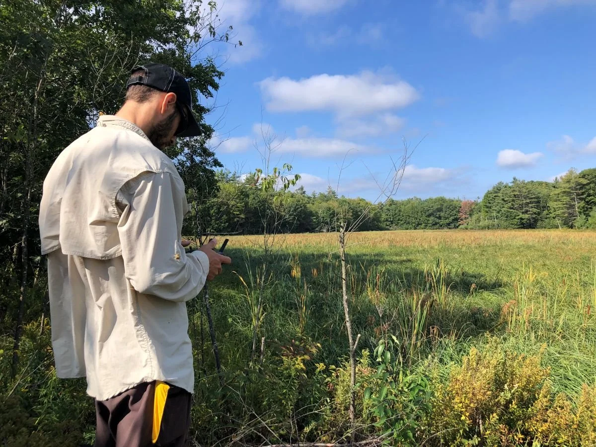
Adam operating the drone
One great example of how drones are being used by the Georgian Bay Land Trust is the Corridor Project - our most ambitious effort to date. The project is designed to protect a connected network of lands along the eastern shore of Georgian Bay. A key component of the corridor involves conservation agreements on long, narrow strips of municipally owned land. Although some of these strips are only 20 metres wide, together they form a grid across the landscape that help prevent development from fragmenting the wilderness they encompass. Since many of these strips of land are far from roads or docks, it is difficult for staff to reach them regularly. With the drone, however, our team was able to capture imagery of more than 100 kilometres of these strips of land in just seven days.
These images now give us a complete snapshot of the Corridor, showing us where human encroachment on protected lands may be an issue. The imagery also allows us to classify habitats with a level of detail that would be extremely difficult to achieve otherwise. For example, with drone photographs we can easily identify wetland types, forest edges, and even forest types (deciduous, coniferous, or mixed forests).
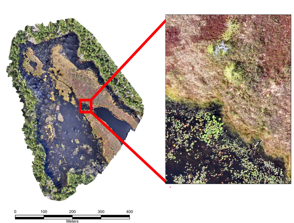
This map of the Red Marsh was created using over 1200 images from the drone. It includes sections of fen, marsh and open water. The inset shows an example of how we are able to classify the different wetland types and can even identify individual water lilies.
Drones also open the door to new ways of protecting Georgian Bay’s ecosystems. With specialized cameras, drones can detect changes in vegetation that are not visible to the naked eye. This makes them especially useful for managing invasive species and detecting changes in vegetation composition and health. By flying the same areas year after year, drones will also help us track how the environment is shifting over time. For example, wetlands are in a constant state of flux and may change in unexpected ways in response to climate change. Whether it is climate change, natural events like fires, or human activity, these repeated surveys will give us a powerful method to analyze change.
The data from drone flights becomes even more powerful when used alongside the other ecological information the Georgian Bay Land Trust collects. By building a database that includes drone imagery, ecological surveys, and fieldwork, we can look at the big picture of how Georgian Bay’s ecosystems are functioning and how best to protect them.
The first year of drone operations has shown just how valuable this tool can be. As the technology continues to improve, the possibilities will continue to grow, giving us new ways to steward the land, water, and wildlife of Georgian Bay.
Adam will talk more about this topic on February 25, when he presents as part of our online LandMark Speaker Series. Please join us! Details and registration are here.